

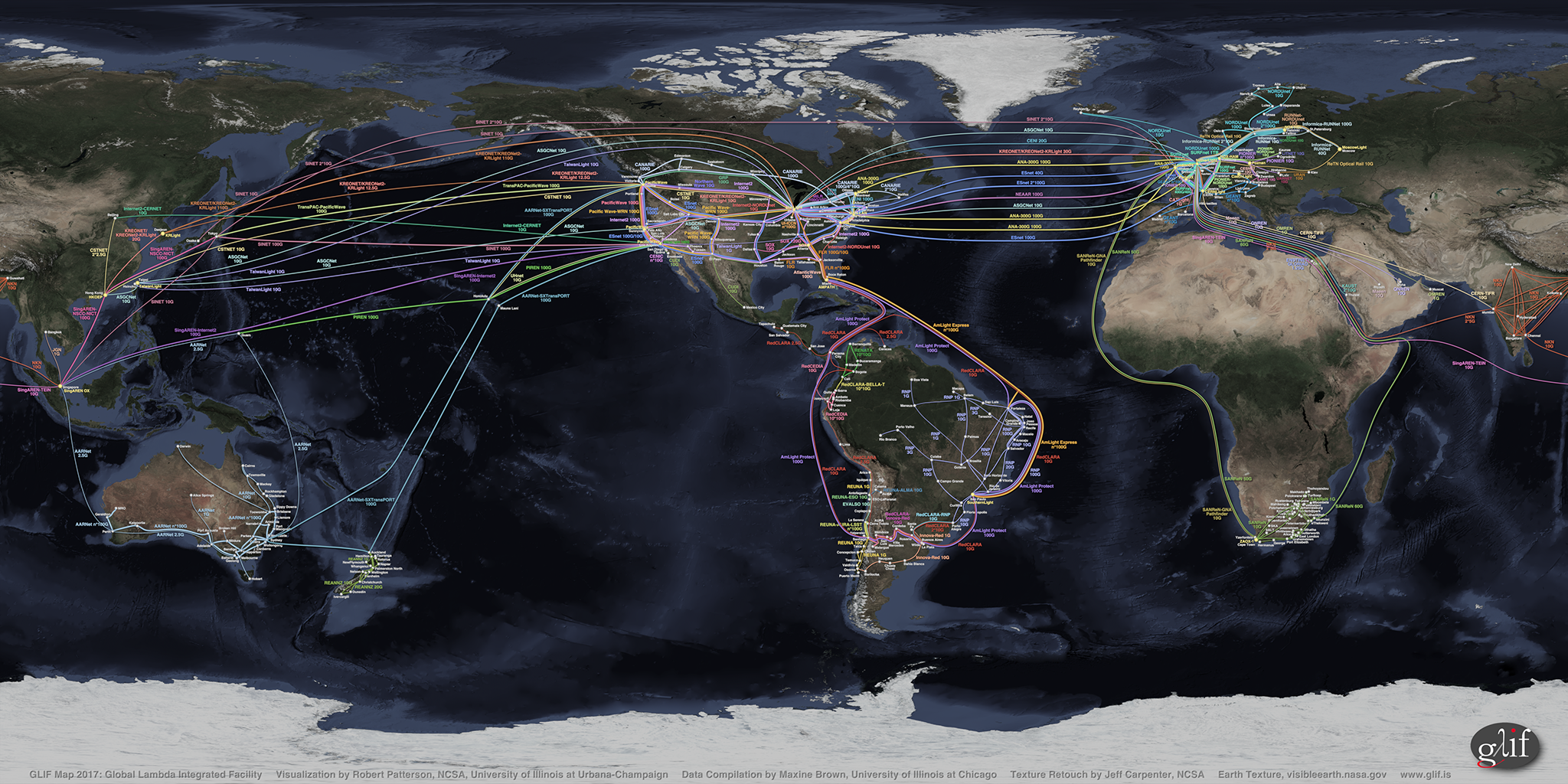
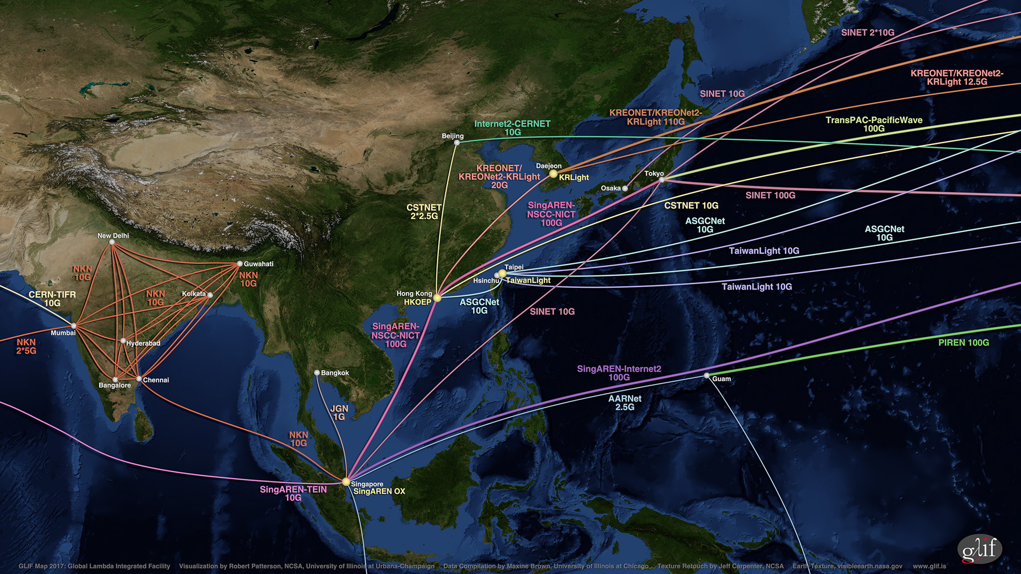
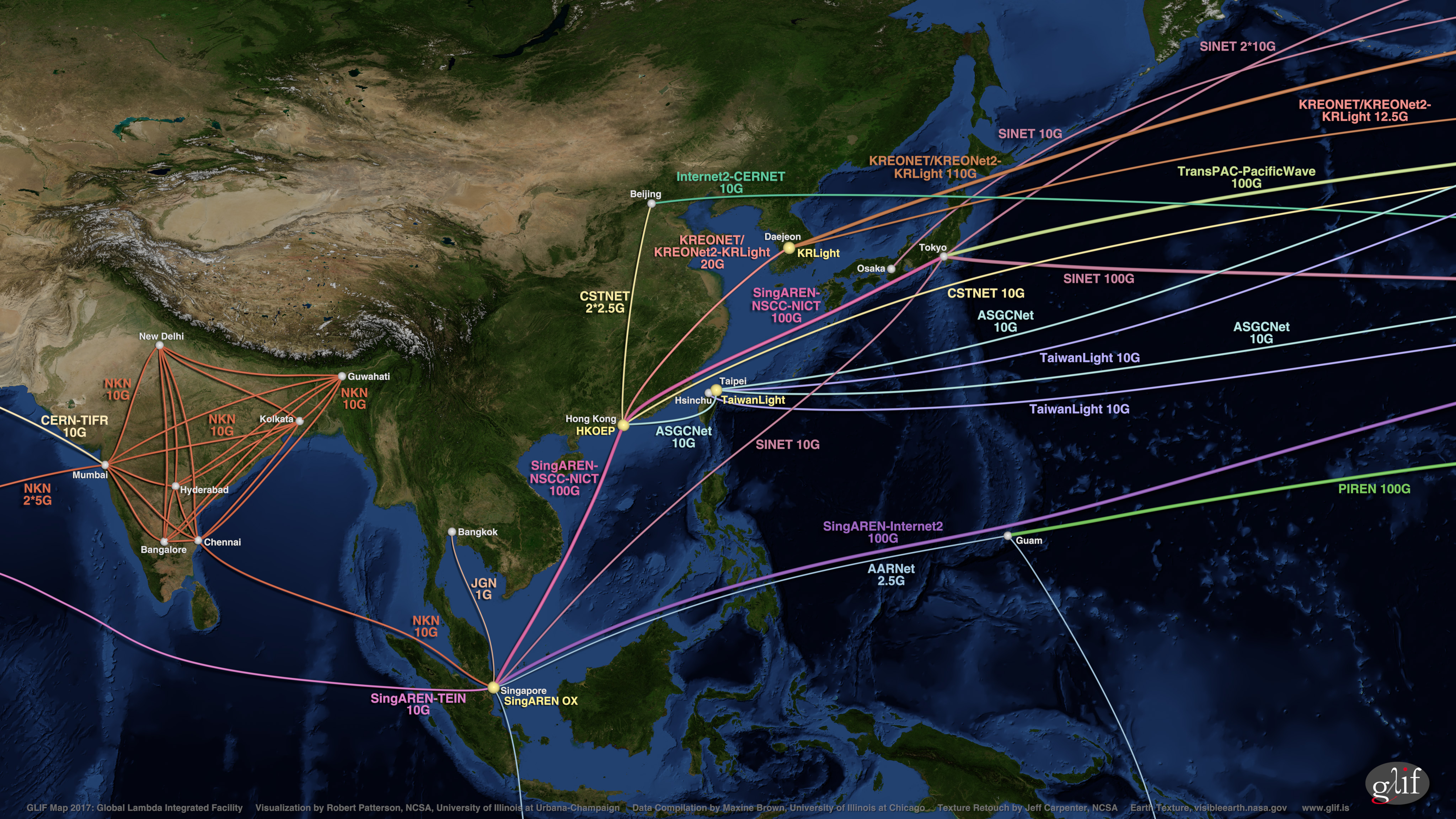
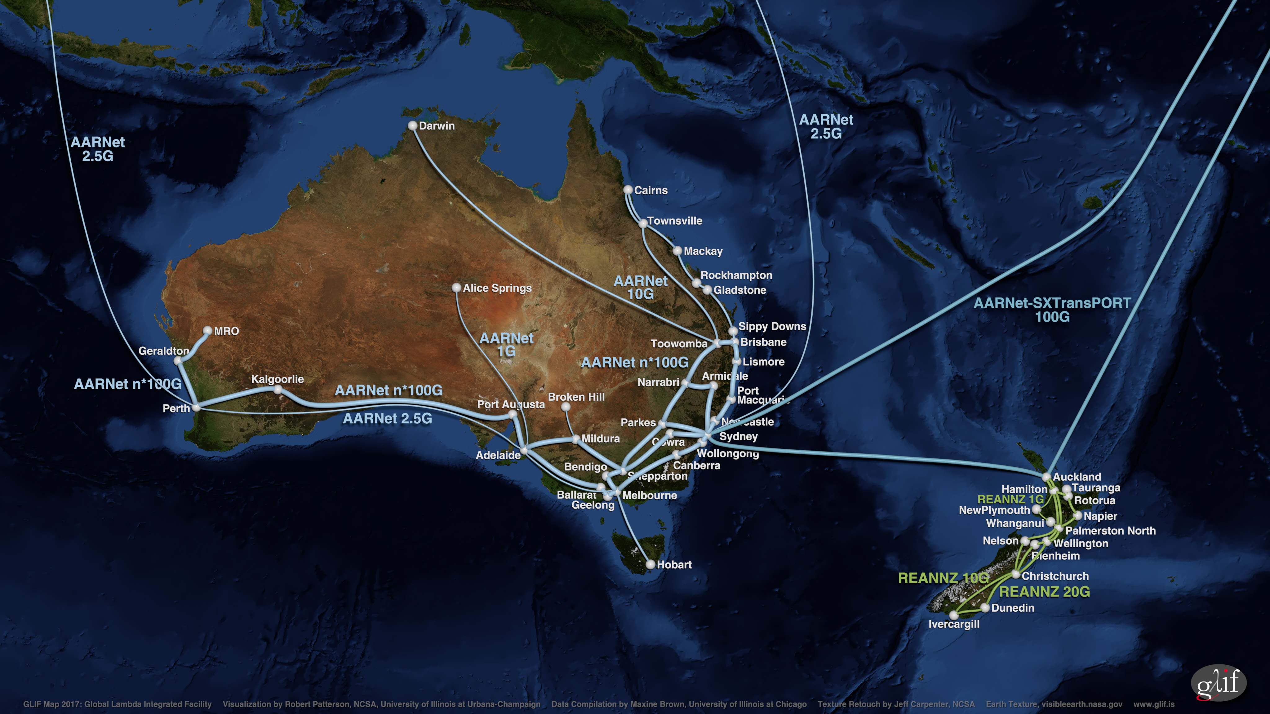
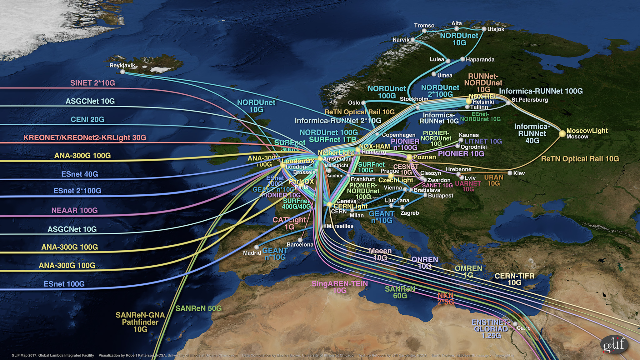
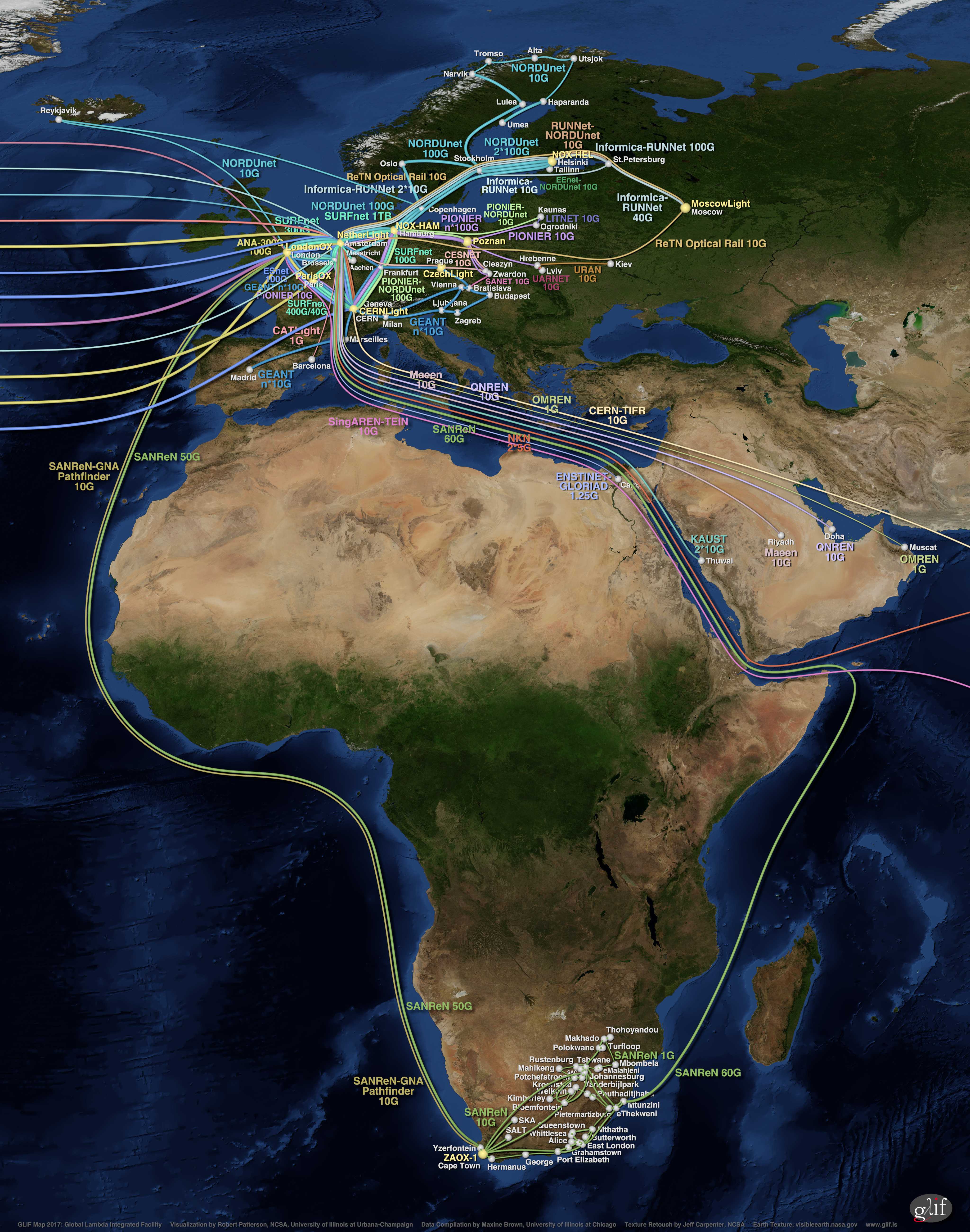
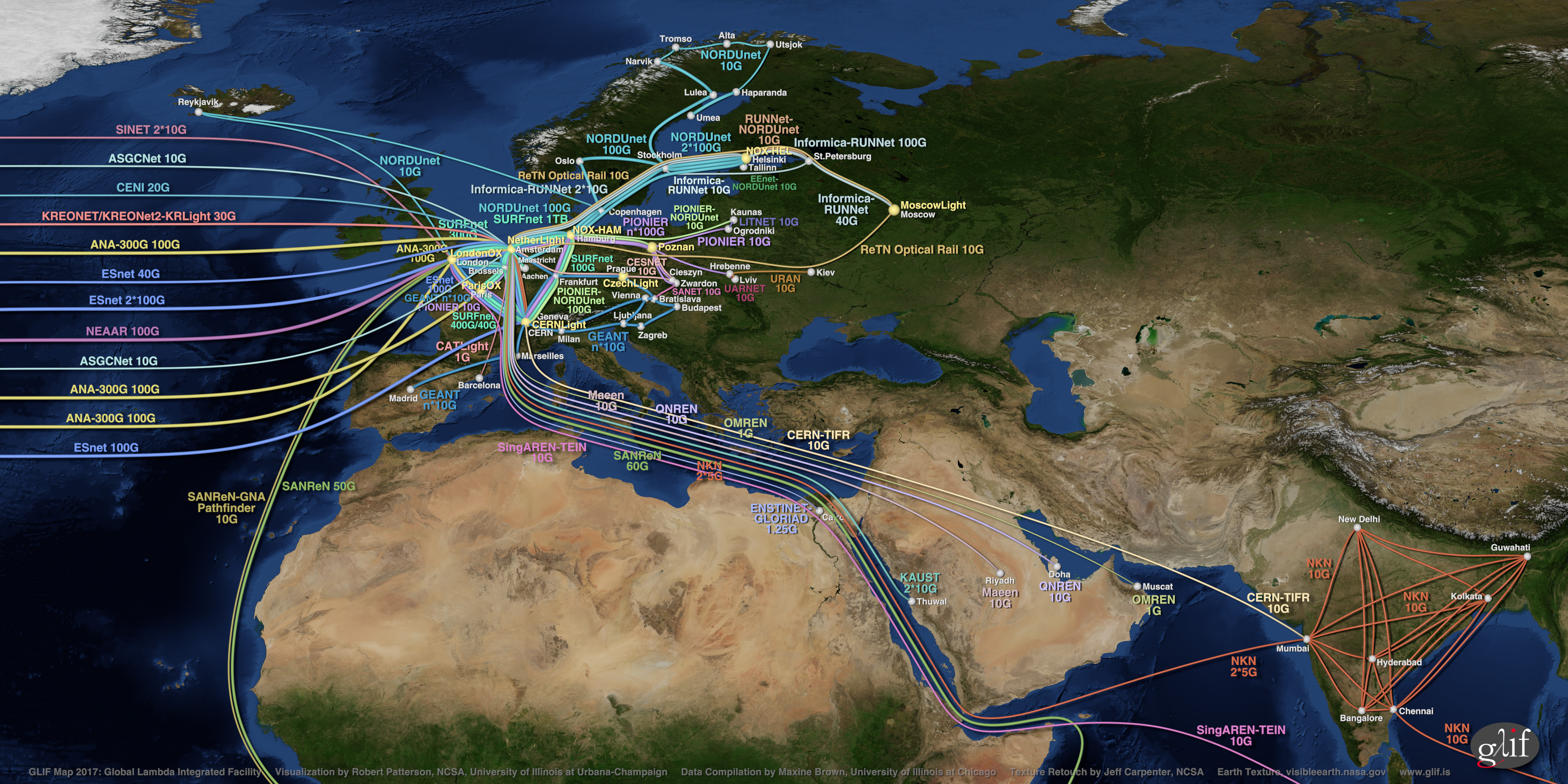
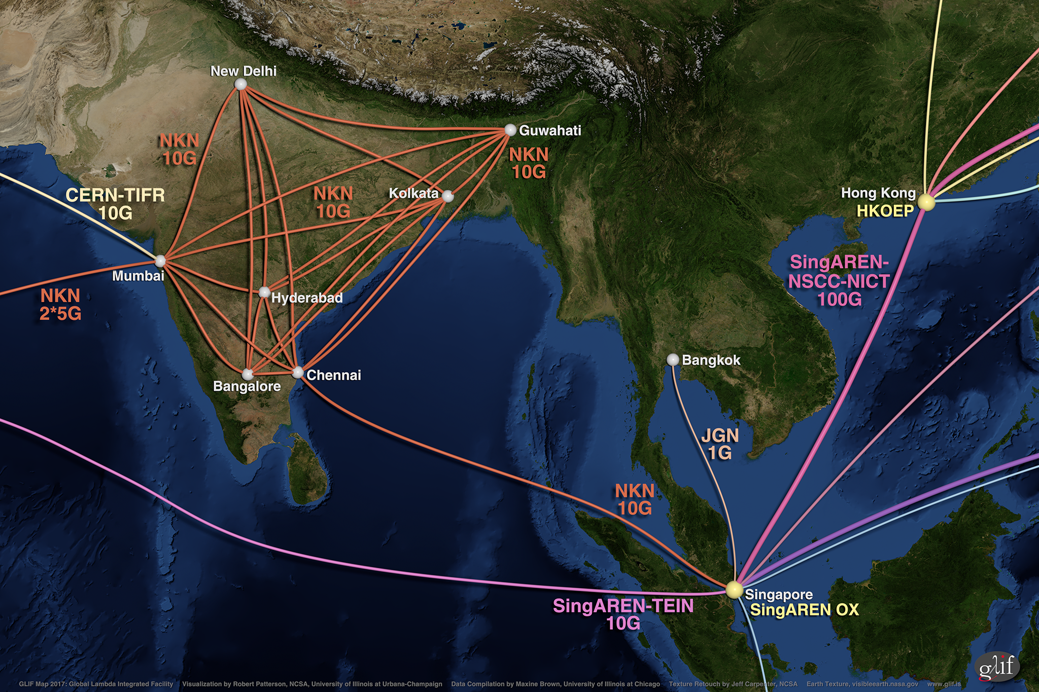
GLIF Maps
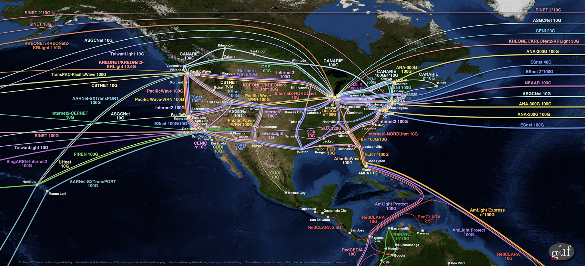
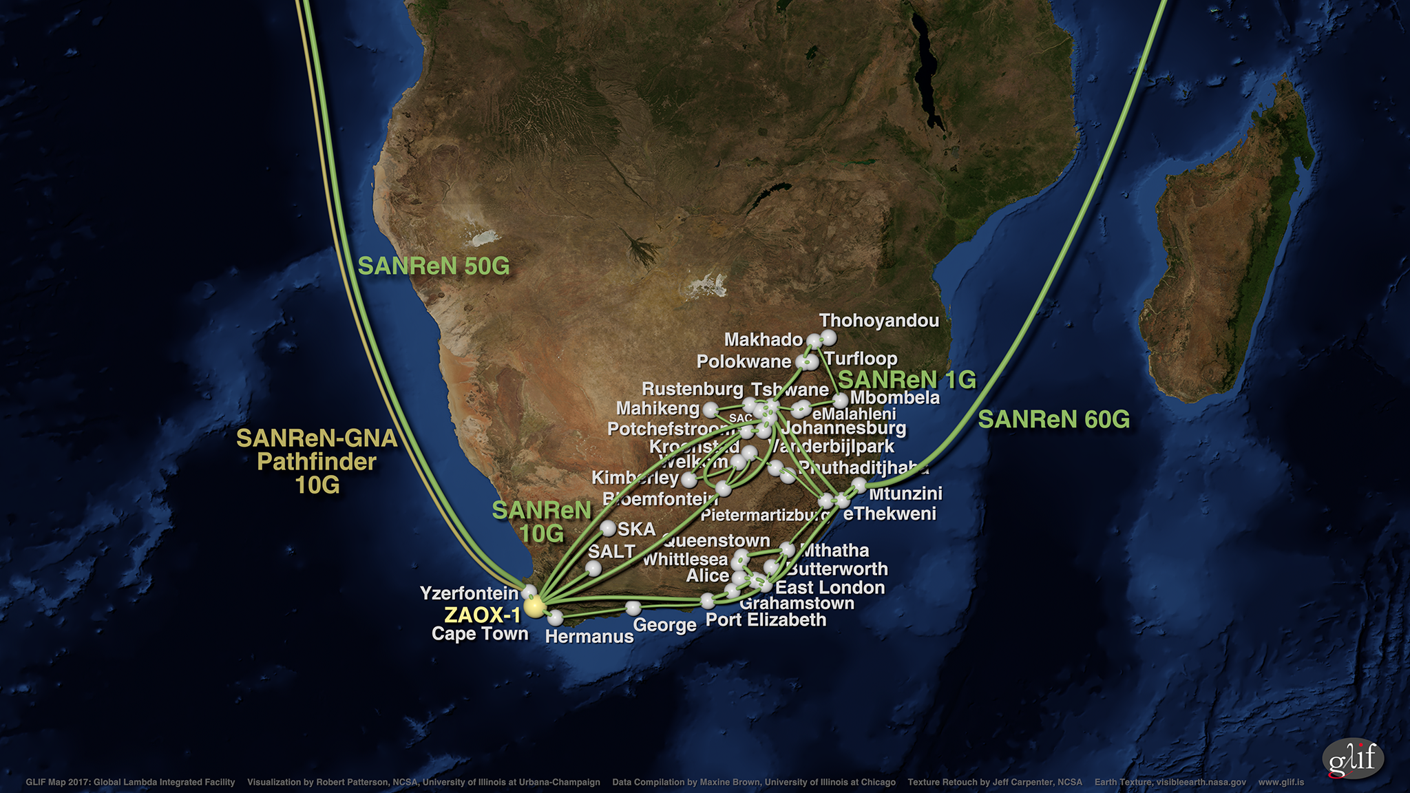
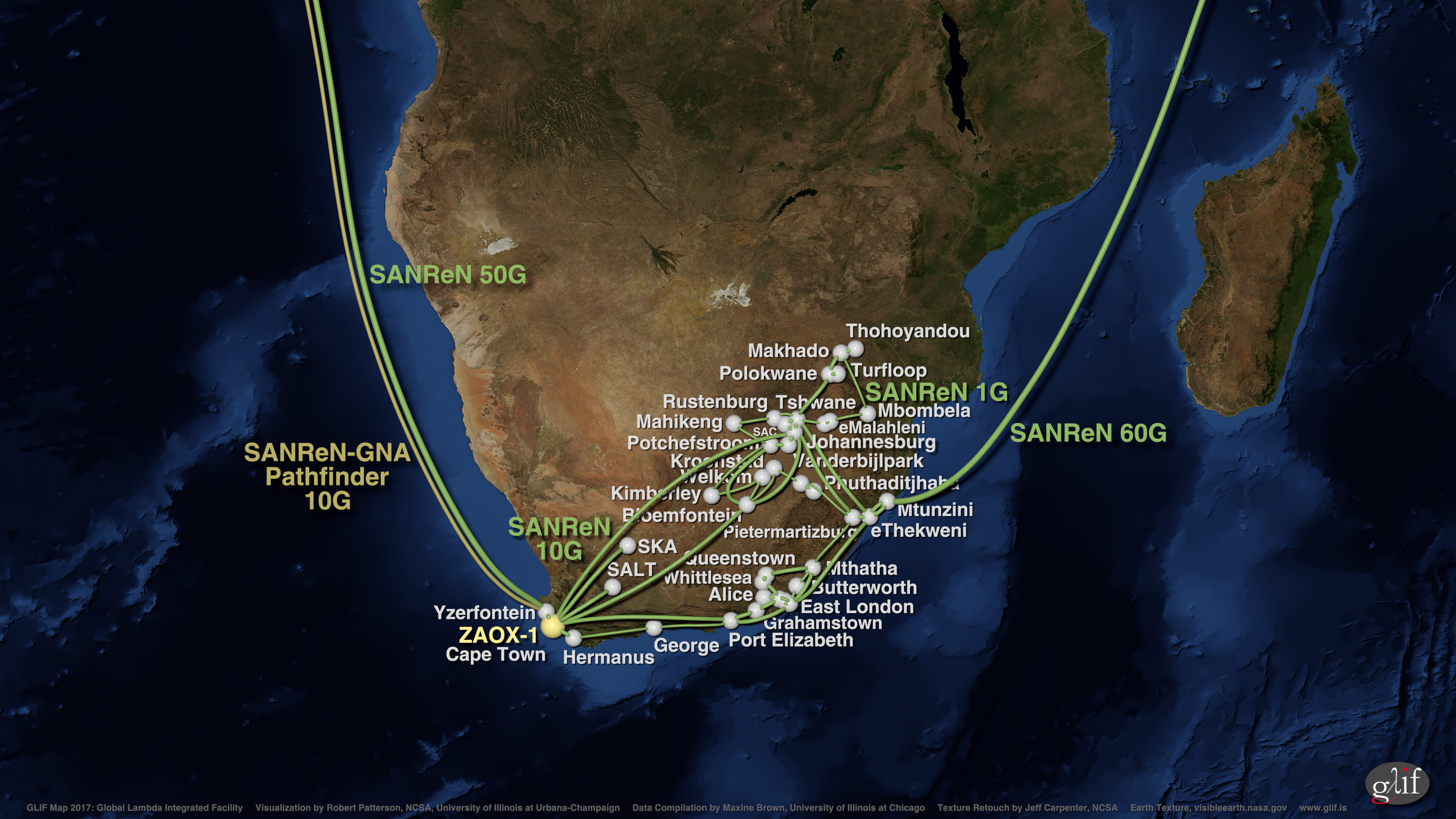
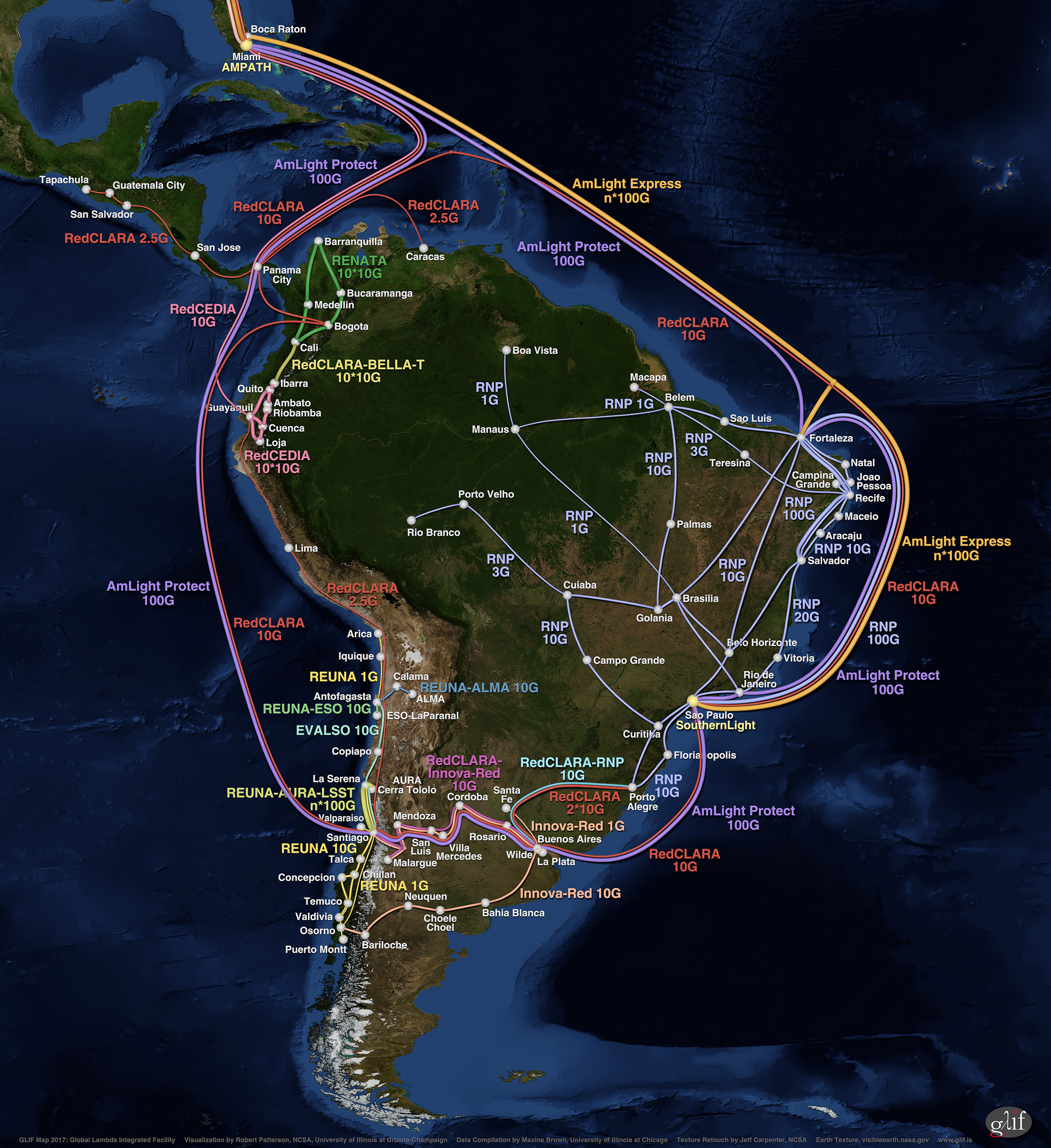
These illustrations of GLIF infrastructure show the international research and education network bandwidth made available for scheduled application and middleware research experiments as of September 2017.
Conditions of Use - These maps are made available in various file formats for use by members of the public who wish to utilise them, or link to the GLIF website. We request that you not alter the image in any way; otherwise, special permission should be obtained from the GLIF Secretariat. We also request that you include the following 'Acknowledgements' (and 'Additional Information' as needed).
Acknowledgements - The Global Lambda Integrated Facility (GLIF) Map 2017 visualization was created by Robert Patterson of the Advanced Visualization Laboratory (AVL) at the National Center for Supercomputing Applications (NCSA) at the University of Illinois at Urbana-Champaign (UIUC), using an Earth image provided by NASA with texture retouching by Jeff Carpenter, NCSA. Data was compiled by Maxine D. Brown of the Electronic Visualization Laboratory (EVL) at the University of Illinois at Chicago (UIC). Support was provided by GLIF, NCSA/UIUC, the State of Illinois and the National Science Foundation award #ACI-1445176 for CADENS (Centrality of Advanced Digitally ENabled Science). For more information on GLIF, see http://www.glif.is/.
Additional Information - The GLIF map does not represent all the world's Research and Education optical networks, and does not show international capacity that is dedicated to production usage. The GLIF map only illustrates lambda networks owned by some of its participants – National Research & Education Networks, consortia and institutions – that have excess capacity they are willing to share with international research teams for applications-driven and computer-system experiments, in full or in part, all or some of the time, when possible. GLIF does not provide any network services itself, and researchers should approach individual GLIF network resource providers to obtain lightpath services.
All Maps (ZIP files)
- All resolutions - JPEG & PNG (1.99 GB)
- Low resolution - JPEG (12.7 MB), PNG (51.9 MB)
- Medium resolution - JPEG (33.4 MB), PNG (174.7 MB)
- High resolution - JPEG (99.2 MB), PNG (598.1 MB)
World Maps (Traditional Background)
- Low resolution (2K) - JPEG (818 KB), PNG (3.1 MB)
- Medium resolution (4K) - JPEG (2.2 MB), PNG (10.7 MB)
- High resolution (8K) - JPEG (7.4 MB), PNG (39 MB)
- Very-high resolution (16K) - JPEG (24 MB), PNG (144.3 MB)
- Ultra-high resolution (32K) – JPEG (70.5 MB), PNG (491.2 MB)
World Maps (50% Saturated Background)
- Low resolution (2K) - JPEG (737 KB), PNG (3 MB)
- Medium resolution (4K) - JPEG (2 MB), PNG (10.4 MB)
- High resolution (8K) - JPEG (6.6 MB), PNG (37.9 MB)
- Very-high resolution (16K) - JPEG (21.6 MB), PNG (139.2 MB)
Asia-India Maps
- Low resolution (2K) - JPEG (892 KB), PNG (3.6 MB)
- Medium resolution (4K) - JPEG (2.4 MB), PNG (12.2 MB)
- High resolution (8K) - JPEG (7.3 MB), PNG (42.3 MB)
Australia-New Zealand Maps
- Low resolution (2K) - JPEG (661 KB), PNG (2.9 MB)
- Medium resolution (4K) - JPEG (1.7 MB), PNG (9.9 MB)
- High resolution (8K) - JPEG (4.9 MB), PNG (33.7 MB)
Europe Maps
- Low resolution (2K) - JPEG (1.1 MB), PNG (3.9 MB)
- Medium resolution (4K) - JPEG (2.8 MB), PNG (12.7 MB)
- High resolution (8K) - JPEG (8 MB), PNG (42.5 MB)
Europe-Africa Maps
- Low resolution (2K) - JPEG (1.8 MB), PNG (7.9 MB)
- Medium resolution (4K) - JPEG (4.9 MB), PNG (26.3 MB)
- High resolution (8K) - JPEG (14.7 MB), PNG (89 MB)
Europe-India Maps
- Low resolution (2K) - JPEG (922 KB), PNG (3.7 MB)
- Medium resolution (4K) - JPEG (2.6 MB), PNG (12.4 MB)
- High resolution (8K) - JPEG (8.3 MB), PNG (43.7 MB)
India-Southeast Asia Maps
- Low resolution (2K) - JPEG (997 KB), PNG (4.2 MB)
- Medium resolution (4K) - JPEG (2.5 MB), PNG (13.4 MB)
- High resolution (8K) - JPEG (7 MB), PNG (44.2 MB)
North America (Close-up) Maps
- Low resolution (2K) - JPEG (1.1 MB), PNG (3.9 MB)
- Medium resolution (4K) - JPEG (2.9 MB), PNG (12.7 MB)
- High resolution (8K) - JPEG (8.1 MB), PNG (41.9 MB)
North America (Wide-Angle) Maps
- Low resolution (2K) - JPEG (818 KB), PNG (2.8 MB)
- Medium resolution (4K) - JPEG (2.2 MB), PNG (9.7 MB)
- High resolution (8K) - JPEG (6.5 MB), PNG (34 MB)
- Very-high resolution (16K) - JPEG (17.9 MB), PNG (113.9 MB)
South Africa Maps
- Low resolution (2K) - JPEG (613 KB), PNG (2.9 MB)
- Medium resolution (4K) - JPEG (1.6 MB), PNG (9.4 MB)
- High resolution (8K) - JPEG (64.4 MB), PNG (31.4 MB)
South America Maps
- Low resolution (2K) - JPEG (1.3 MB), PNG (5.6 MB)
- Medium resolution (4K) - JPEG (3.4 MB), PNG (19.3 MB)
- High resolution (8K) - JPEG (9.8 MB), PNG (56.7 MB)